

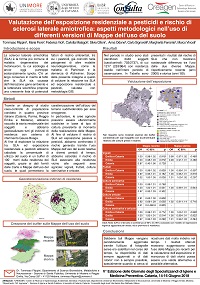
Background and aim: Amyotrophic Lateral Sclerosis (ALS) is a neurodegenerative disease with still unknown etiology. Among possible environmental risk factors, we considered pesticides exposure. In a population-based case-control study we retrieved historical residence of subjects and we collected their coordinated in the Gauss-Boaga reference system, in order to evaluate passive exposure to these chemicals in relation to data of land use. Methods: Land Use Charts allow characterization in relation of uniform using area. Although land modifications over time require continuous updating of information, unfortunately the availability of historical data is not always possible, especially when trying to retrieve very old data. Dealing with this issue, the study aims to assess the difference depending on which Land Use Chart is implemented, using the risk of ALS as case study. We performed unconditional bivariate and multivariate regression models adjusting for sex and age. Results: Subjects included in the study were in total 3440 (703 cases and 2737 controls). In order to evaluate the two charts (one of 2000s for recent period and 1980s for ancient one), we carried out specific analysis only on subjects who never changed their address during study time. Final analyses were conducted in 1217 subjects (253 cases and 964 controls). Results shown no substantial difference between Land Use Chart used. Conclusions: Our data suggest that, when historical data were not available for Land Use Model, the use of more recent information to estimate ancient exposure could be a possible and valid choice.